

Preamble
The Larapinta Trail is a magnificent track hike for anyone who has got some overnight hiking experience. Here are some points you may consider:
- Don't rush - take time to enjoy your experience, some of the best features are on side trips;
- This is not what we classify as a remote walk, there is a lot of access to civilisation along the way;
- Everyone has a different idea of walking the Larapinta and all are good;
- You don't have to be 100% fit, if you take your time you will get fit along the way;
- The track is very well marked and if you have moderate hiking experience you should not get lost;
- It is not desert, but rather semi-arid and you normally find shelter from the sun;
- In our opinion, you should always carry a tent. Most of the time the inner will suffice (e.g. to keep out mice), but for the unforeseen wet weather event you should always carry a fly with your tent;
- Always carry emergency gear e.g. PLB or similar;
- Best campsites depend on preference:
- If you like socialising and do not want to carry extra water, then Trail Heads are the best;
- If you like to be alone, have more scenic sites and don't mind carrying extra water, mountain tops (e.g. Counts Point, Hill Top Lookout etc.) and watercourses (e.g. Stuarts Pass etc.) are ideal.
Day 1 - Alice Springs Telegraph Station to Wallaby Gap
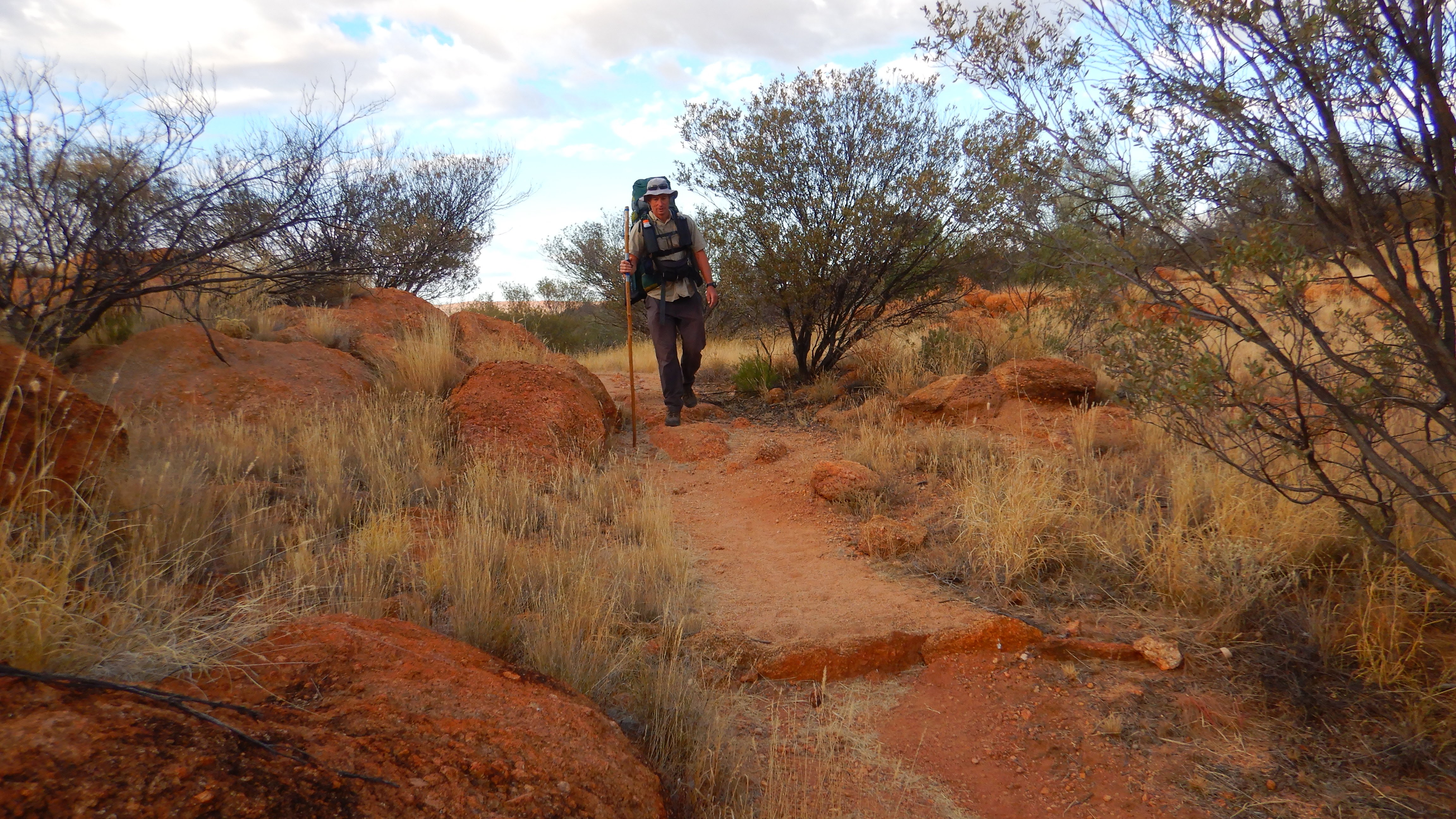
Dear Diary, I am feeling very Olympic this morning. Maybe the two cups of coffee have something to do with this. Kerrie and I are super excited to start the Larapinta Track. Awesome Peter, an Alice Springs local dropped us off at the Alice Springs Telegraph Station at around 7:30 and we were on our adventure just before 8:00. Our packs are well balanced, i.e. Kerrie’s is about 18kg and mine is around 25kg. This includes about 3 litres of water each and Ferdinand, our mascot.
Straight away civilisation was left behind and we meandered through rolling hills passing a bit of history.

At about the 5km mark we caught up with an organised group, who unfortunately had one hiker whose sole of their boot had come off completely. We help by supplying them with our roll of duct tape and zip ties. Hopefully, that will see her through for the day or longer until she can replace her boots or fix them more permanently.
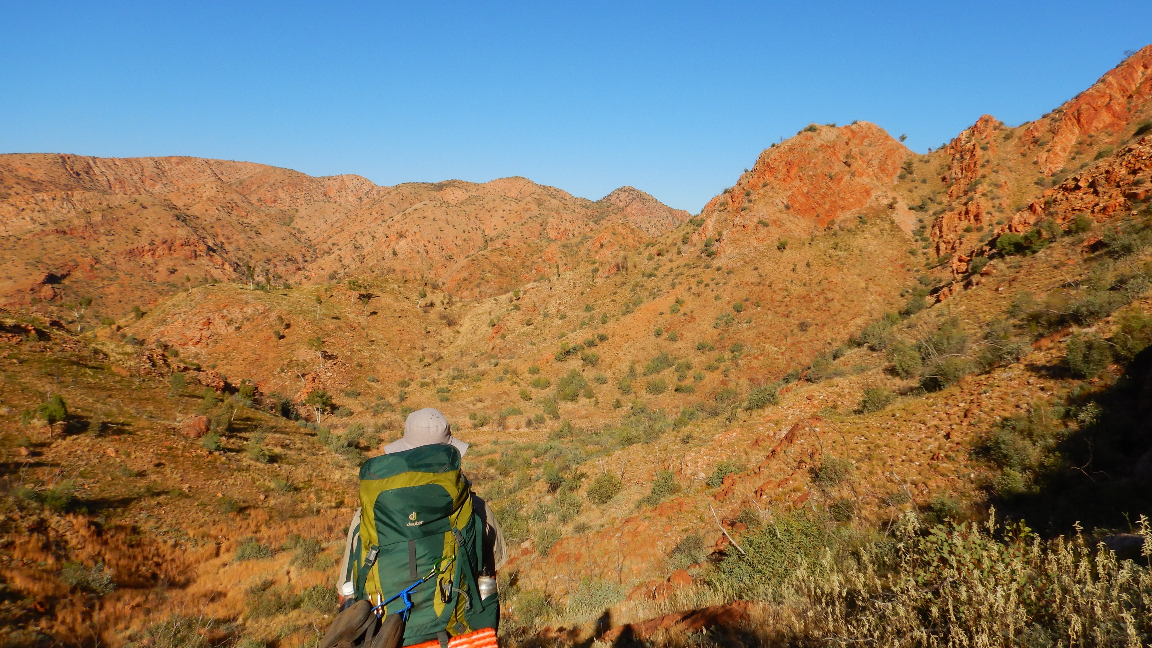
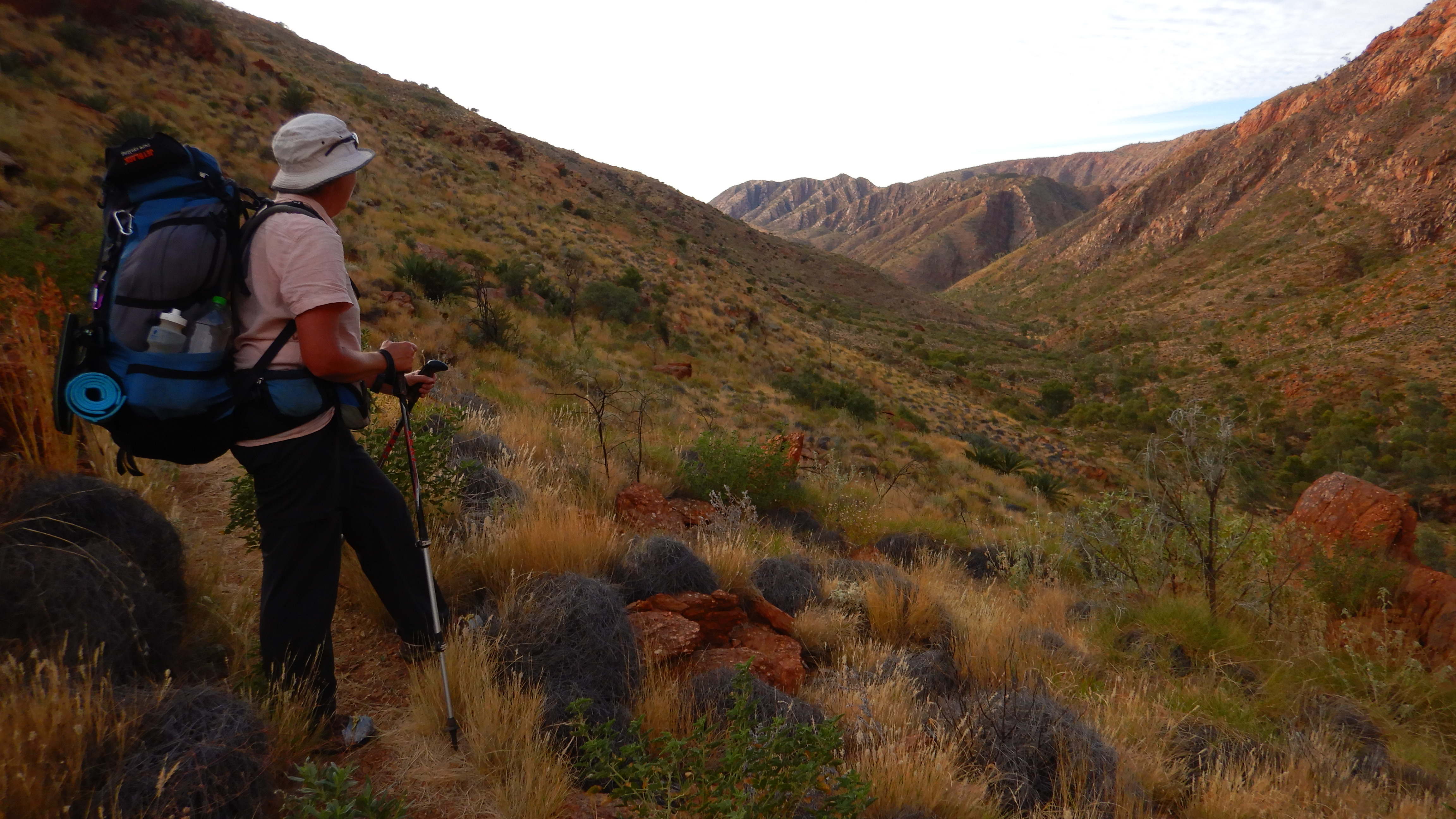
Now the hills start to get a little bigger, giving us great views over the surrounding countryside including Alice Springs and the Ilparpa Range.


From there it was not far down to Wallaby Gap where we had lunch around 13:00. We were tempted to go on, but then decided to stay and enjoy the camp. That way we also cut out walking during the hottest part of the day. A quick side trip into the nearby gorge followed by cooking our first camp meal. Only one day into the hike and we were enjoying ourselves, feeling all tension caused by civilisation drain out of us.
So far the track is very well defined and good walking. As we are wearing long pants, our gaiters seem superfluous and we may ditch them at our first drop box in Standley Chasm.
Day 2 - Wallaby Gap to Simpsons Gap
After a good night’s sleep, both of us felt pretty good. We set off around 07:30 for another reasonable warmup section. As both of us were not very fit, the plan is to take it easy for the first 5 days to work up a bit of fitness.
The track out of Wallaby Gap was through grasslands.

It was easy, undulating walking and after 3.5 km we took a detour to Scorpion Pools, which were very idyllic, especially after clambering upstream a bit. Unfortunately, there was no swimming and the water was covered with green algae.
Fairy Springs was our next detour, where the water was a lot cleaner, but not good for swimming either. Ah well, we just had to stay smelly. I was sure that it would get worse anyway.

After some flattish walking for 2km, we came up alongside Rungutjirba Ridge.

It was awesome snaking along the lower south side of the ridge and finally veering around Hat Hill Saddle before descending into Simpsons Gap by 13:30. Here we enjoyed a late lunch before walking to the nearby camp to set up.


At camp, we met a few other hikers and talked a lot of good nonsense before a nice satay beef & rice dinner and as usual an early bedtime.
Day 3 - Simpsons Gap to Mulga Camp
After a couple of false starts, due to Kerrie battling mice, we had a good night's sleep and got up at 05:00. Yes - we have a habit of getting up early!

But not as early as two other hikers who had already left at 01:00 to finish their last section i.e. the section we had just walked over two days. I believe they wanted to be at MacDonald's for lunch!
We left earlier today at 06:45 to beat the heat and we enjoyed the magnificent colours of the early morning sky as we began walking.

Our packs are starting to get a bit lighter but we also decided that we would drop a bit of gear at the food drop box (Standley Chasm) to lighten our load.
The first 9 kms to Bond Gap were slightly undulating and winding around small hills.


Bond Gap, so far, was one of our highlights. The gorge (gap) is a bit of a detour off the main track but provides an impressive swimming hole. Although the water was freezing, Kerrie had a quick "tea bag" dip and I had a longer session. After spending an hour there we were totally invigorated and clean.


Skirting Arenge Bluff...

...we came back into more rolling hills, before meandering into Mulga Camp at 13:00. I've never had so many friends as I do today. At least a million flies ride on my back all the time (ok, ok, I didn’t actually count them, but it was a rough guess).
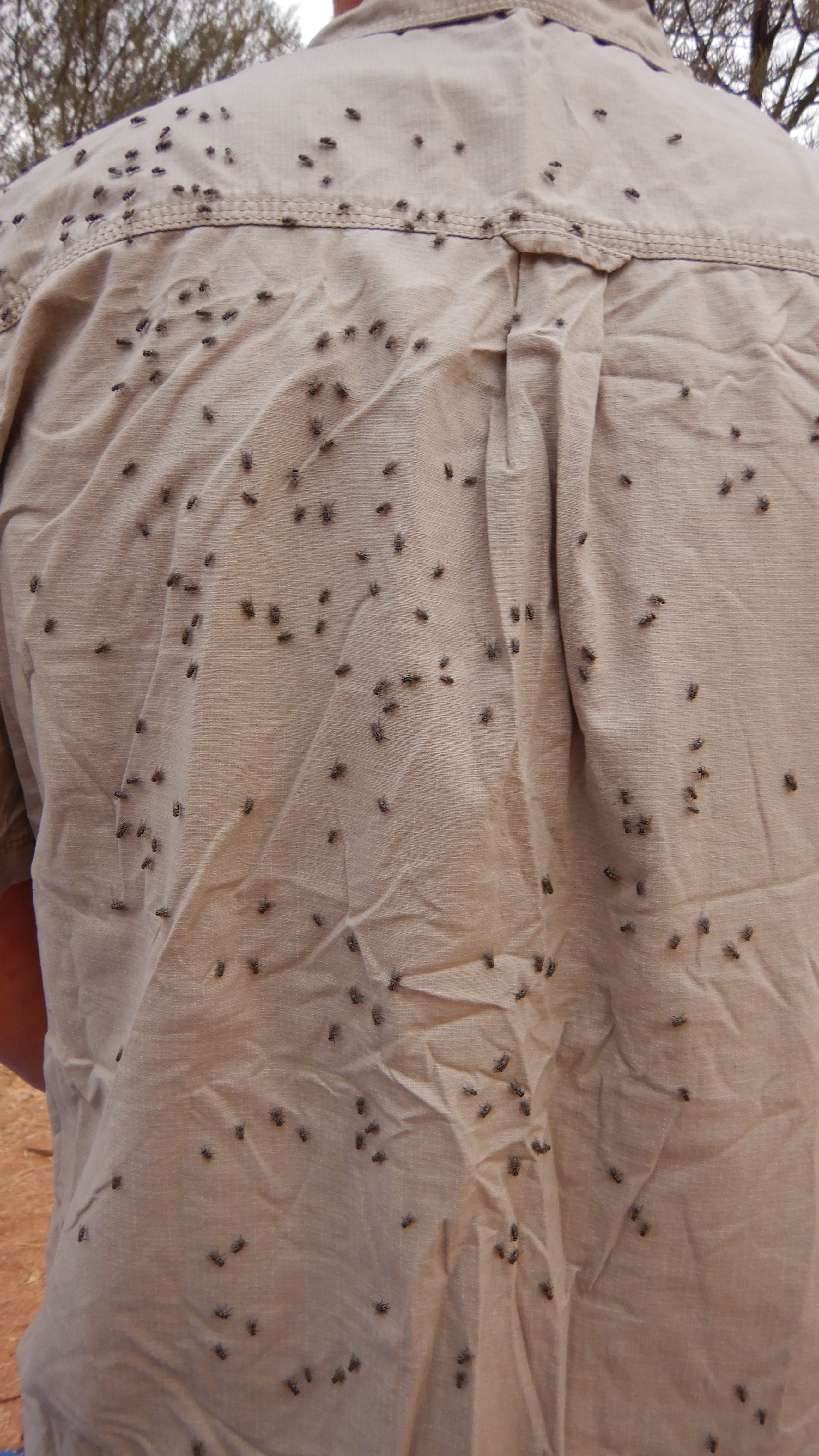
If I had that many followers on Facebook, I would be an influencer.
Tonight’s dinner was Spaghetti Bolognese and once again we beat the sun to bed.
Day 4 - Mulga Camp to Jay Creek
With an easy day ahead we set out a bit later and were on the track by 07:30. We thought this may be an easy day and it turned out as such. I think we had been a little spoiled with views, as this day we considered less spectacular, but saying that it was still awesome.
Shortly after leaving Mulga Camp, we traversed through Spring Gap. There was some water in here and cows seem to frequent it often, judging by the tracks. We assume it’s cows and not Water Buffalo, although we would have been prepared as we have watched Crocodile Dundee several times. Spring Gorge itself was very nice with a cool breeze blowing through.


There were no major hills (not that we are complaining) and we had morning tea on a ridge at around the 6 km mark.

As so often is the case, we should have gone just that little bit extra as at 7 km there was an even better morning tea spot.


Unfortunately, Jay Creek (near camp) was dry, so no swimming, but the good side was that we had a perfect sandy camp spot in the creek rather than the actual campsites, which were full of Three Corner Jacks (burs). During the hike, we met a lot of people that had punctured sleeping mats due to burs, luckily Kerrie used half a foam mat under a blow-up mat and I only used a foam mat.

Day 5 - Jay Creek to Standley Chasm
Today was all about getting to the burger. But first a spectacular day's walk with many, many photos.
Another early start at 6:45 saw us heading out along the scenic creek bed.


This year's earlier floods made this a common sight along the trail.


....but we soon discovered our error when we reached Fish Hole proper soon afterwards.

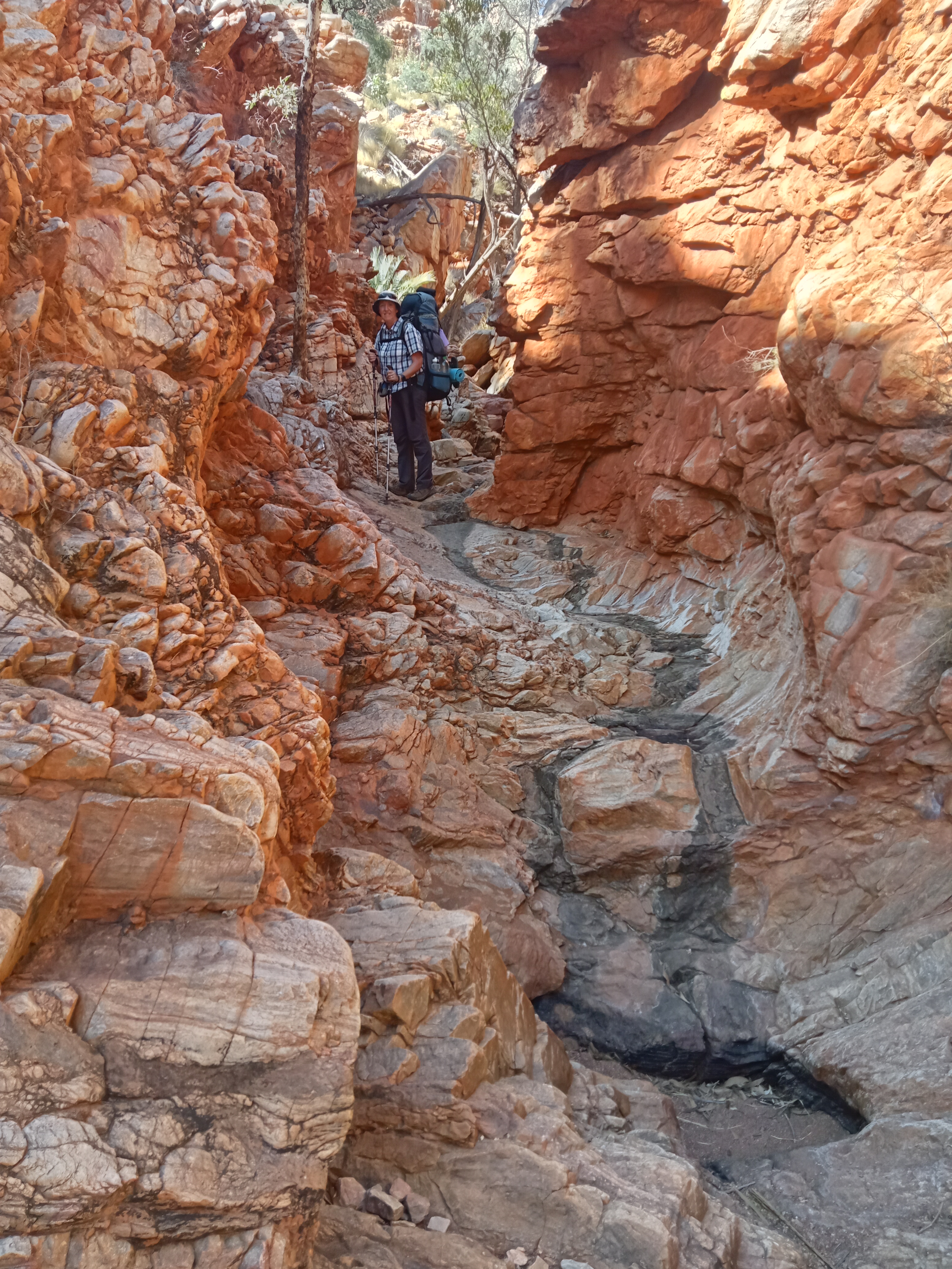
It was then a short clamber up and around Fish Hole.


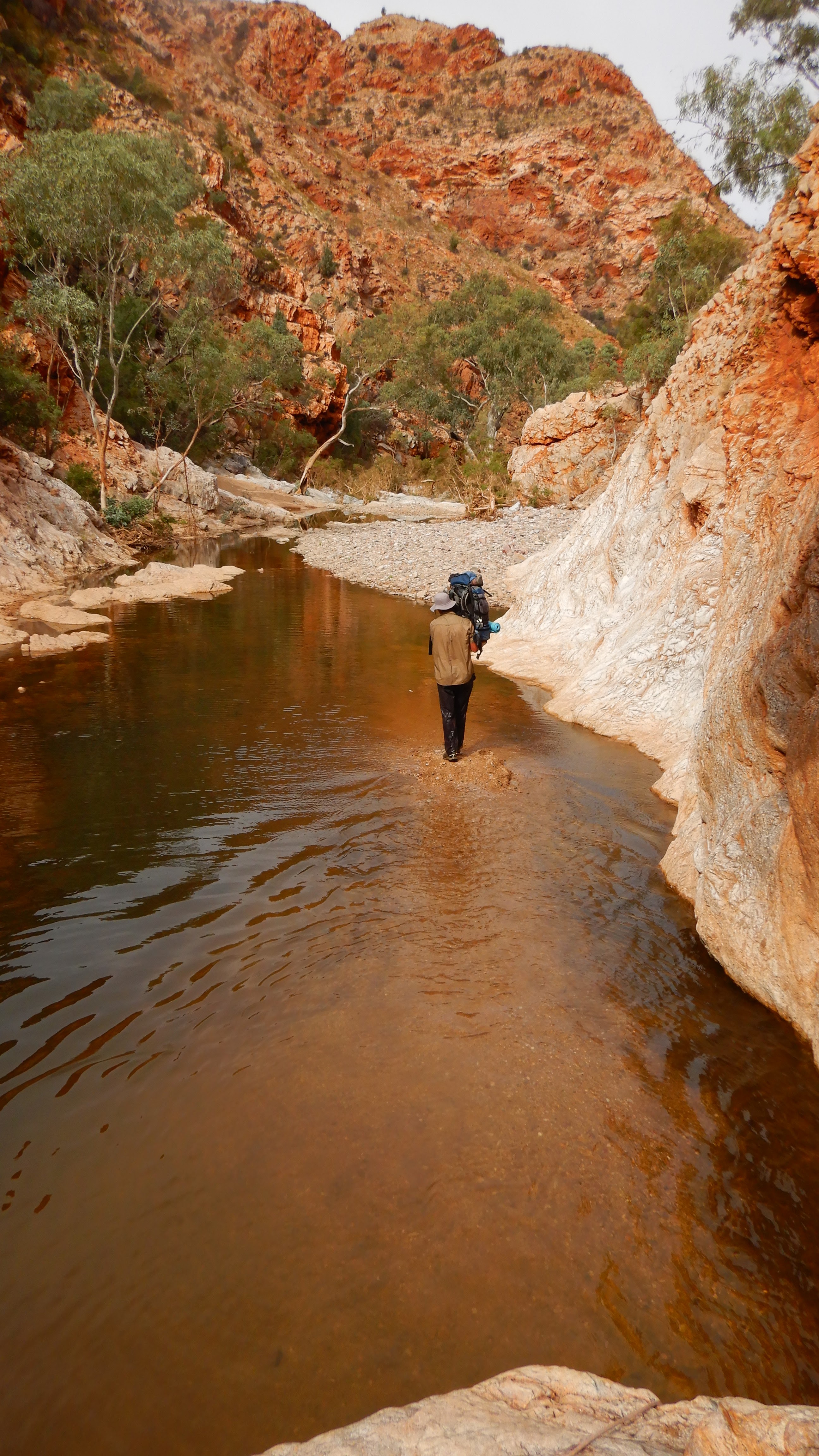
We then had some democratic discussions, and it was decided to take the official low route rather than the high alternative route. Mind you, the low route still entailed some hills! Not sure what the high route was like, but the low route was spectacular with little canyons, nice river scenery and an awe-inspiring 'pound-like' valley. The walking was a bit slower along the river with a few little obstacles, but nothing too hard that we needed to take our packs off for.


Once the tracks merged again, we traversed the river some more, climbing a dry waterfall.


At times we were being watched!

We wound up towards a saddle that provided breathtaking views down both valleys.

Here we met a nice tour group that had come up from Standley Chasm. They even offered us lunch, which we declined, as we were looking forward to our burgers at the Standley Chasm cafe.
From here we thought we only have a cruisy hike into Standley Chasm, unbeknown to us we were faced with a couple of steep ups and downs (around the actual chasm) before finally descending onto the chasm tourist path.

We decided to check out the chasm before the final sprint to the campground. The chasm is amazing and we could just imagine what it looks like when the sun shines into it.


At camp, we first had a shower, which felt awesome and did a load of washing with the free machine provided to campers. Then we devoured the yummy burgers that we had waited for all day. Sorting out our drop box (which felt like Christmas), dumping as much unnecessary gear as possible and then relaxing took up the rest of the day.
Day 6 - Standley Chasm to Stuarts Pass
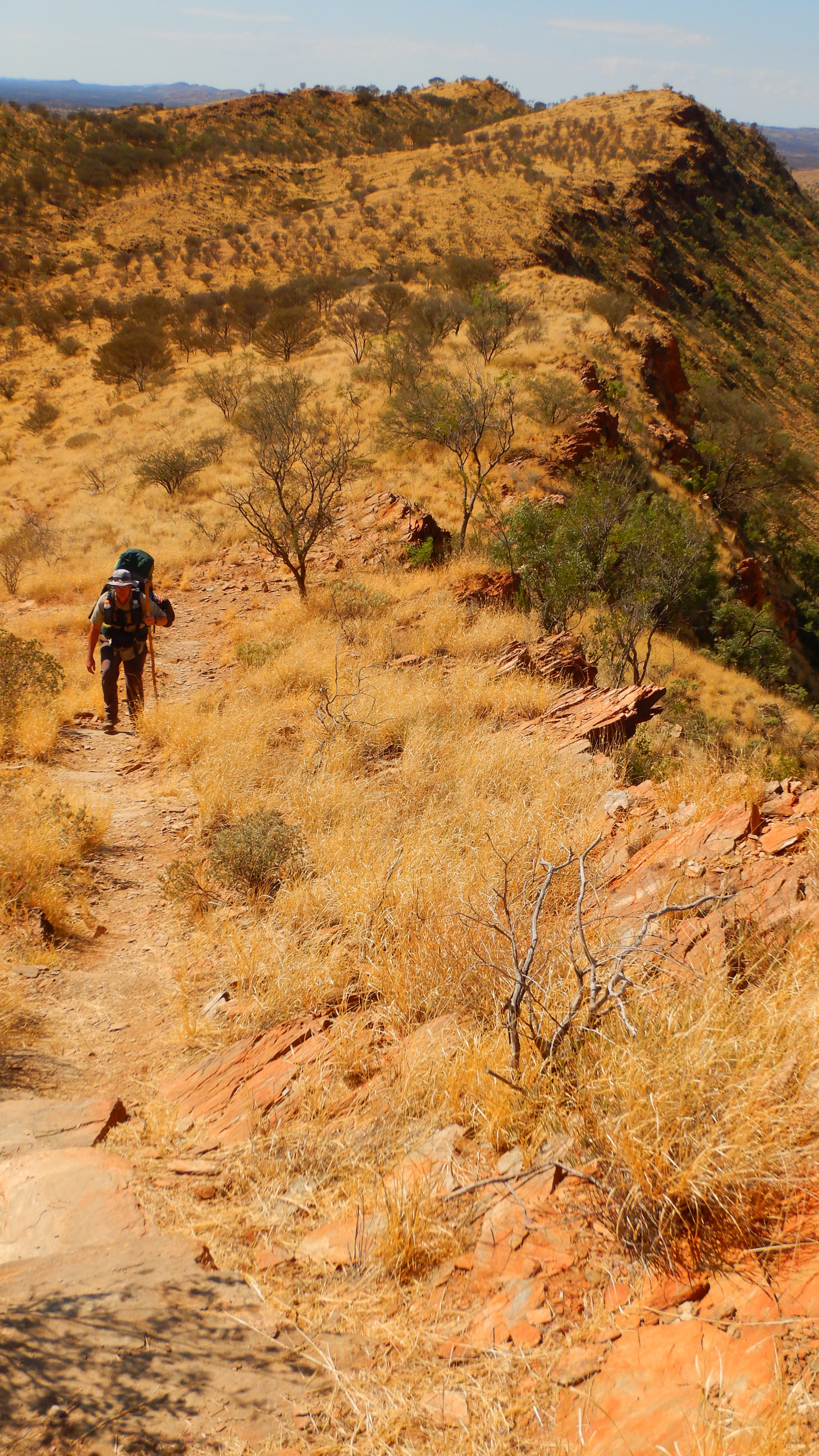
With our packs being the heaviest of the trip (even after dumping some stuff) i.e. 6-7 days of food and 14 litres of water between us we were ready to tackle Brinkley's Bluff ascent. Once again it started with following a watercourse until we headed up. After about 4 km we had a rest stop and I realised that my hat was missing (better than my head I guess) which I had jammed into my belt. Fortunately, another hiker found it a couple of kms back and brought it along. Back together with my hat, we kept on ascending and were rewarded with the most magnificent views.


Bridle Path lookout gave us the most spectacular panoramic views as well as a geocache that we found easily. For some reason, I had in my mind that the bluff would be around 8 km, but it turned out to be just over 10 km. Although the packs were heavy, we hardly noticed the effort as we were continuously awed by the landscape as we ascended.


Where's Wally (or in this case Kerrie)?


As we finished lunch around 13:00 we decided not to camp on Brinkley’s Bluff, but to push on for a few more hours. We said goodbye to a hiking buddy who had walked the same distances as us for the first 5 days. The lady decided to camp on the bluff to experience the sunset and sunrise, which will be amazing.
We left for Stuart’s Pass and followed a windy goat track down the steep hillside all the way to Rocky Cleft, where we came across the first two runners of the 230km+ MacMonster race. It was another hour downhill before we reached Stuarts Pass which offered us a creek camp with magnificent views of the mountain range, especially at sunset!


This campsite turned out to be our favourite, with a magnificent night sky and magic surroundings.
Day 7 - Stuarts Pass to Fringe Lily Creek
I woke up at 04:30 with some Dingoes howling in the distance and thought that this would be a nice time to get up for a couple of coffees and watch the day break.
Standley Chasm camping may be worth $18.50 (this includes access to the chasm), but this campsite is priceless (and it was only $4 per person). The cliffs in the background, the moon, stars and total tranquillity which money cannot buy. We both watched the sunrise and the cliffs change colour before we packed up.
Kerrie’s boots seemed to have a bit of a gap between the shoe and sole yesterday, so I checked them out and realised that the soles are starting to come off. We were both not happy chappies, especially as we handed over our good duct tape on the first day. All we had was what was wrapped around the “stick” (my hiking pole) and that duct tape didn’t stick so well. But some additional string may make the boots last until we get to Serpentine Gorge, where we have some shoe glue in our next drop box. But that’s five days away. So fingers crossed.
Off we went on our merry way and the first 3.6 km to 4/5 Junction we knocked over in just one hour. The walking was very easy on good trails. Once at the Junction, we detoured and checked out Birthday Waterhole, where we also found a geocache.


As it was neither of our birthdays, we carried on.
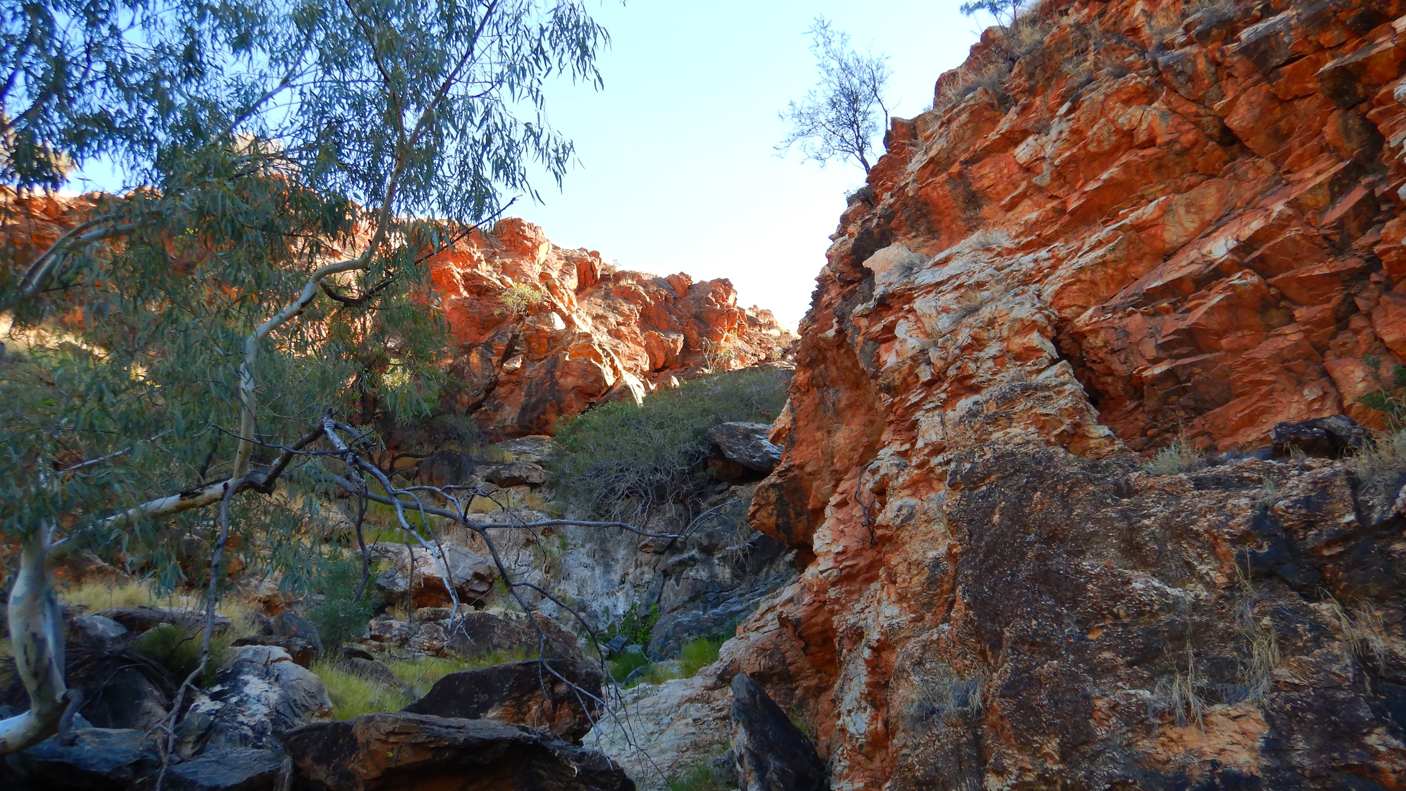
From here on it became a slog up the creek and through Spencer Gorger and once again all the effort was worth it. We kept on going steady and strong up to Windy Saddle via Rocky Talus, where Kerrie decided to take a dive and crash, smashing her shoulder on some boulders. After some quick checking, I could confirm that the boulder was OK (so was Kerrie).


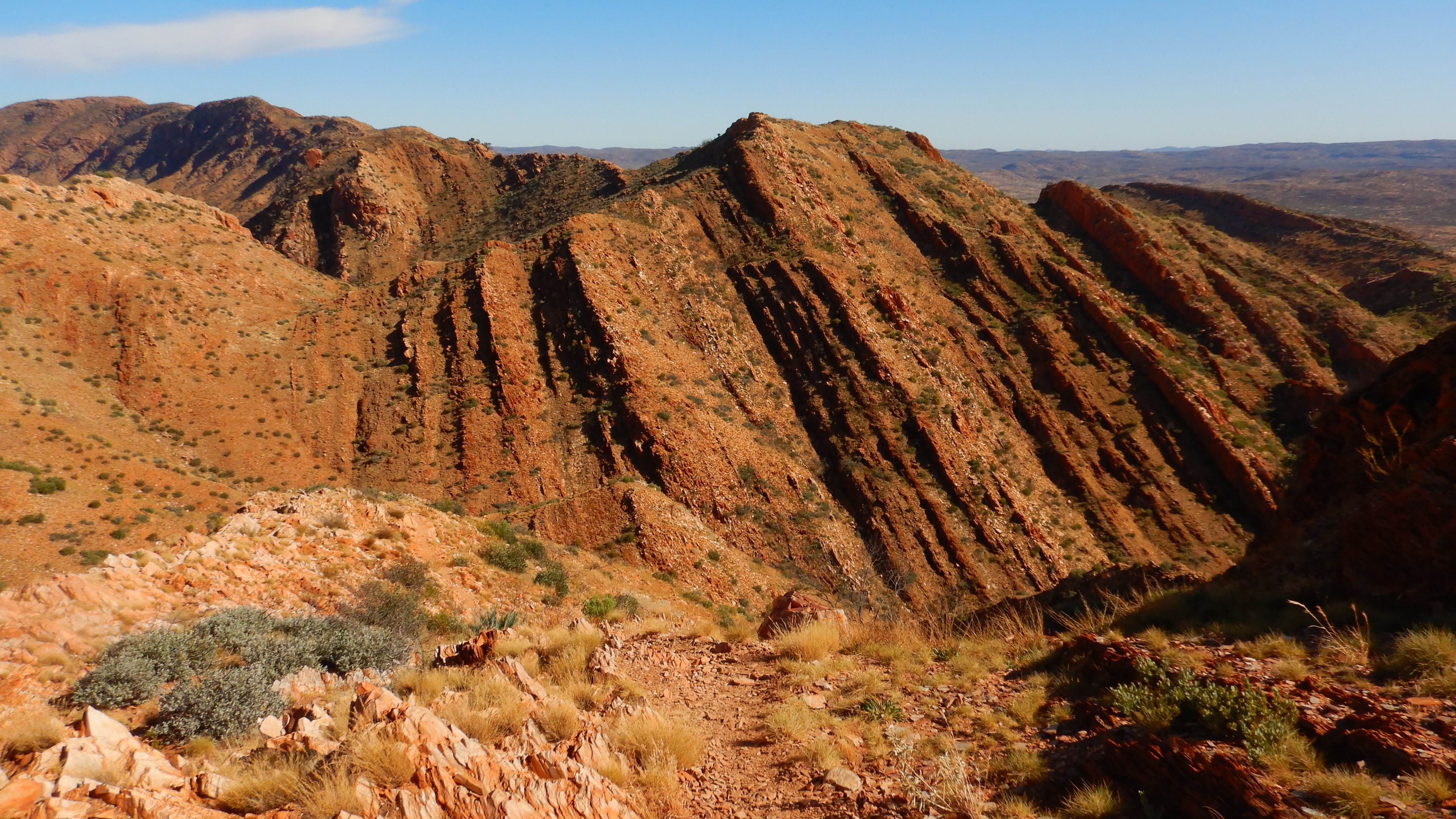
A short stop at Windy Saddle to enjoy the views and adjust some minor sock issues. It was a bit further uphill before we came to Razorback Ridge, which took our breath away. Don’t worry it is not as scary as it looks and we followed a safe track for about 1 km along its top.


By this time I am sure to have shrunk an inch with today’s pack weight being similar to yesterday's. The switchback down the hill to Fringe Lily Creek campsite was a nice change in path compared to the rock hopping we had all day.
Before we set up camp at Fringe Lily we both enjoyed a cool swim in the gorge. We didn’t even bother taking our clothes off as this is our new way of washing ourselves and our clothes at the same time.

Now we were ready to set up and have dinner while contemplating why on earth we carried an extra day’s worth of water for the fun of it, as there was plenty here. But then again better safe than sorry.
Day 8 - Fringe Lily Creek to Ghost Gum Flat
Dear Diary, it is 17:30 and what a day. A day of awesome sights, hard slogs and mice. But I am getting ahead of myself.
We both slept in until 06:00 but it was still dark for another 30 minutes. Kerrie’s boots are still pretty much the same as the day before but I replaced a couple of strings just in case (and knocked on wood that they would last).
We were hitting the trail (actually we just walked on the trail) at 08:00 and followed a creek up to Rocky Saddle. It was hard going, but not as tough as yesterday and we also didn’t carry the extra water. Views aplenty.....


Arriving at Hugh Gorge Junction we leave our bags behind as we head up towards Hugh Gorge North. The half-hour creek traverse was well worth it to see the gorge proper with its clear pool of water.


We decided against a swim as it was a bit chilly and we knew that we had a swim ahead of us (in other words we chickened out). After some time enjoying the gorge with its beauty and tranquillity we headed back to the track.

Not far along Hugh Gorge South, we came to a waterhole blocking the path (the anticipated swim).

We checked it out and it looked deep. I thought I spotted a possible way bouldering across the east wall. Kerrie was a bit dubious and wanted to waterproof at least the electronics sitting in the top of my bag. But I finally convinced her that “I got this”. A short time later I was hanging on the rockface about 1 meter above the water and wasn’t that certain about the whole situation. In a split second my backpack and I made a stunning dive into the pool for total submersion.

Well, I guess I didn’t “nail that one”. As soon as I got to the shore I pulled out the electronics and to my dismay, they were a bit wet of course. If any of these would have been broken I would have been in sooo… much trouble by Kerrie.
Also from my isolated beach, I could clearly see that the western side was mainly only a foot deep and the backpacks could easily be lowered from the rock above (which I assumed impassible from the other side). Later we met four other people that also went the way I did. Three made it and another also fell into the water with all her gear. That made me feel a lot better and less dumb.
Now that we knew the way, Kerrie had no problem getting through the obstacle. I retrieved Kerrie's pack and she took a quick 3m swim around the rock.

From here on it was pretty straightforward rock hopping through the remainder of the gorge. We only had to wade through a little more water, which we could have avoided, but once again only realised when we got to the other side.

We arrived at Hugh Gorge campsite at 14:00 and decided to push on to Ghost Gum Flat campsite. There are no facilities there, so we had to load up with water.
We were starting to tire but hiked the 7 km to camp in less than two hours along easy meandering tracks. Although we were tired, these tracks seemed extremely good after two days of rock hopping.
Did I mention that each night we spent with a varying amount of mice? As we set up camp at Ghost Gum Flat there were dozens of them checking us out. But there are no other people here, so we can put up with the little critters, after all, they don’t eat too much and are fairly quiet.

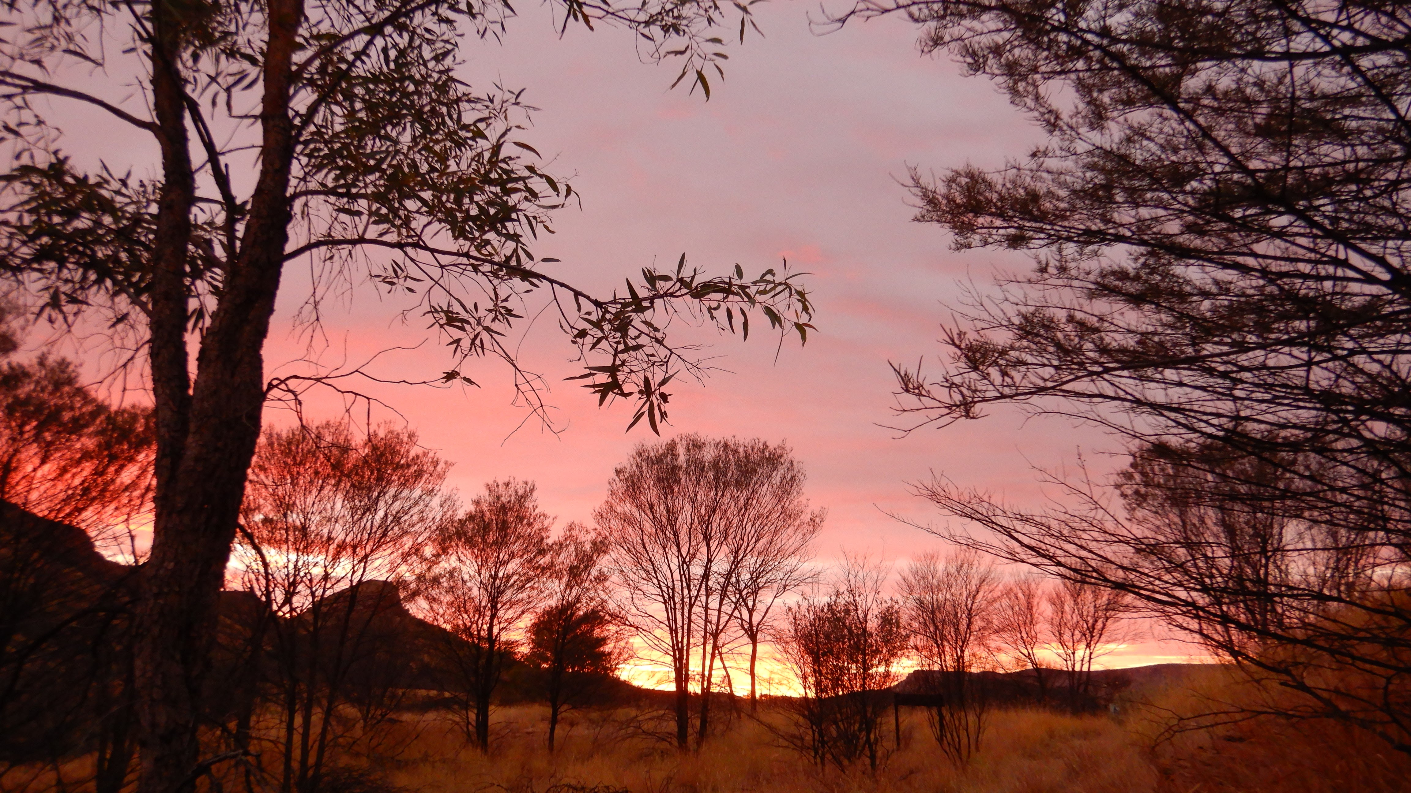
Another magic sunset to finish our day.

Day 9 - Ghost Gum Flat to Ellery Creek North
After an entertaining night listening to mice run up the tent and then slide down we got up at 05:00. I am glad that we could be an amusement park for all the mice.
Kerrie’s boots still seem OK (knocked on wood, crossed fingers etc). 07:00 sees us off on our longest distance day yet. But it is meant to be a relatively easy walk. As we meander through the small hills, and yes we seemed to go up every one of the little buggers, along the way, we have great views of the south and north ranges. The only other highlight was Rocky Gully campsite, where we filled up with water for the day.


At lunchtime, we found a nice shady spot in a creek, where we ate Ryvitas and cheese (again!!!) and lay down for 20 minutes.

From here it was only a couple of hours to Ellery Creek North, for a nice swim,....


....and re-fixing Kerrie’s boots.

Here the mice seem to have been replaced by millions of flies. At least we are never lonely. At this campsite, we actually socialised as there are five other people here as well (I know me socialise, wonders never cease).
Day 10 - Ellery Creek North to Serpentine Gorge
Nothing unusual happened at night and I was woken by Kerrie at 05:30. By 05:31 I was into my coffee ritual of 3 cups before anything.
Totally caffeinated at 07:30 we set out towards Serpentine Gorge. After the initial little climb, we wound our way through the hills until we had to scramble through a little gorge to join up with the Ellery South track again. Once again we seemed to walk over every hill there was before ending a short and relatively easy hiking day at Serpentine Gorge.


Here we enjoyed picking up our food drop, which included a nice small bottle of red wine for me as well as the all-important shoe glue for Kerrie's boots.

The first thing we did was glue Kerrie’s boots while chatting to other hikers. We explored Serpentine Gorge with our sandals (while the glue was drying).


As usual, we went to bed with the sun going down and listened to all the mice scurrying around our tent looking for food.
Day 11 - Serpentine Gorge to Serpentine Chalet Dam
During the night we heard some animated talking and found out that a young couple had mice eat through their tent and instead of two people in the tent there was now also a mouse. And that’s what caused all the commotion.
Kerrie’s shoes look promising now, all glued up for the rest of the hike.
On our way out of camp, we dropped off some surplus gear in our drop box and after heading across some grassed areas we soon headed up Heavitree Range.


It was a pretty decent climb up, but we are feeling a lot fitter now. The hike across the plateau gave us more magnificent views and the detour to “Counts Point” surprised us with the most spectacular campsite and park bench to sit and enjoy the glorious views. Unfortunately, we didn’t have enough water with us to take advantage of this super campsite, but we enjoyed a nice morning tea instead.


After we wound our way down the range for an hour and a bit, we found a nice shady spot for lunch. The way into Serpentine Chalet Dam led us through a landscape that changed from shrubby trees to fairly open grasslands through rolling hills.


At the campsite, we inspected Kerrie’s boots, which seemed to be holding up well.
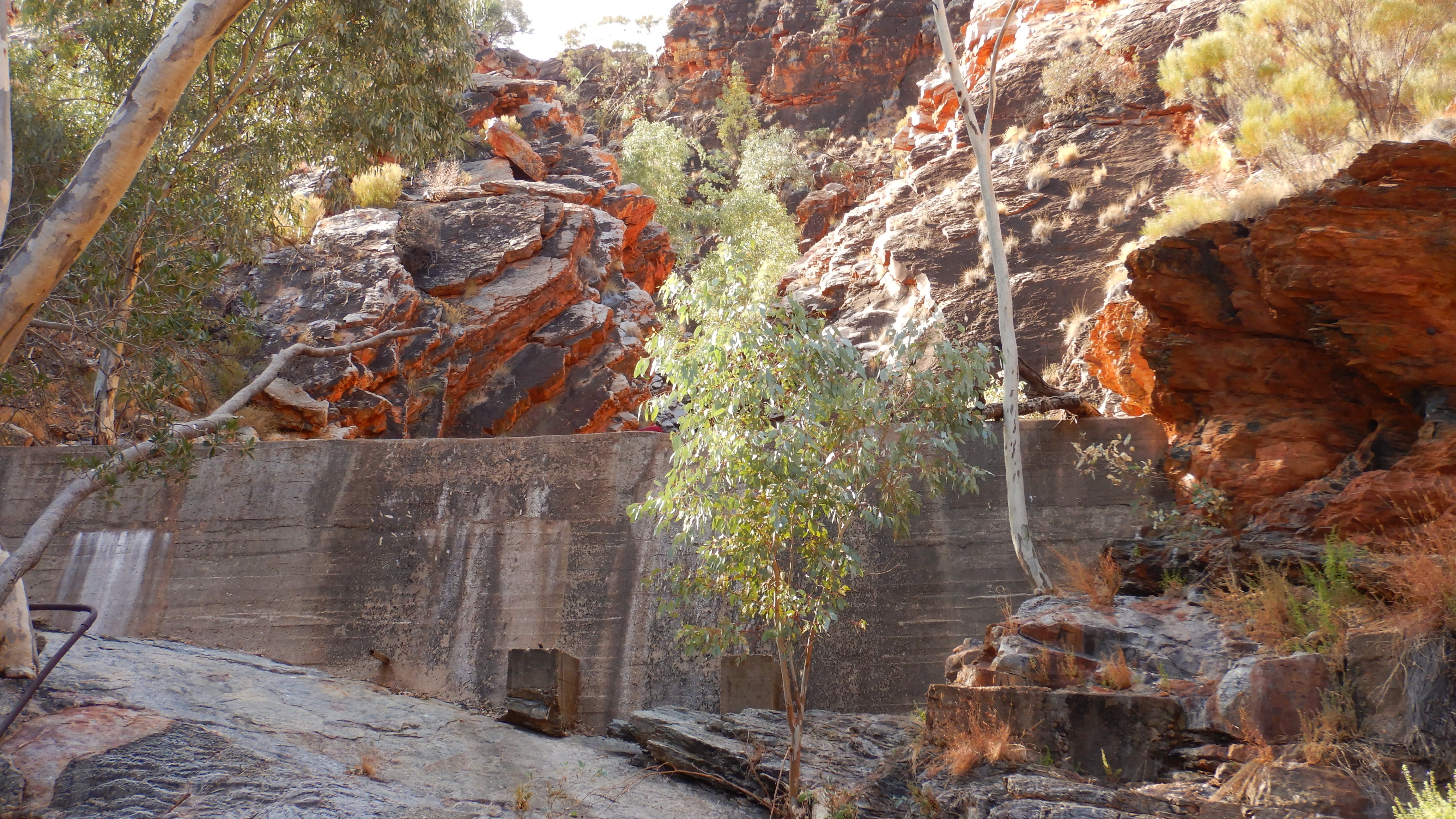
The swimming hole is actually an old small dam that was built to supply water to a tourist chalet in the 1950s. Unfortunately, that venture did not succeed, but it provided us with a cold although refreshing swim coupled with a wash of our clothes!


Our campsite furniture was once again welcome.

Here the mice are just on another level of crazy, they even climbed up Kerrie’s back while she was sitting down. Ah well, hopefully, they will leave us alone at night as our food bags are hanging high in the trees.
Day 12 - Serpentine Chalet Dam to Mt Giles Lookout
Just on my second cup of coffee at 05:30 when a large tour group came through with torches set to high beams, just to make sure everyone else was awake too.
Everything started out nice and easy and I had no warning about the day ahead. We arrived at Inarlanga Pass where things started to get a bit harder, with a lot of rock hopping through the pass. I was feeling Olympic and was powering along.


Next, we turned west looking up a long long valley. The way seemed steady uphill, uphill and more uphill, with sharp upturned rocks making foot placement important!


It was very scenic and the going seemed pretty good although I didn’t realise that Kerrie was struggling. The valley seemed never-ending, but we finally made it through the saddle, where Kerrie had a minor meltdown because she was exhausted. This made me feel terrible as I was feeling great and I didn’t notice Kerrie struggling.
From here on we took it really slow down the next valley (with it's view of Mt Sonder) to Waterfall Gorge.


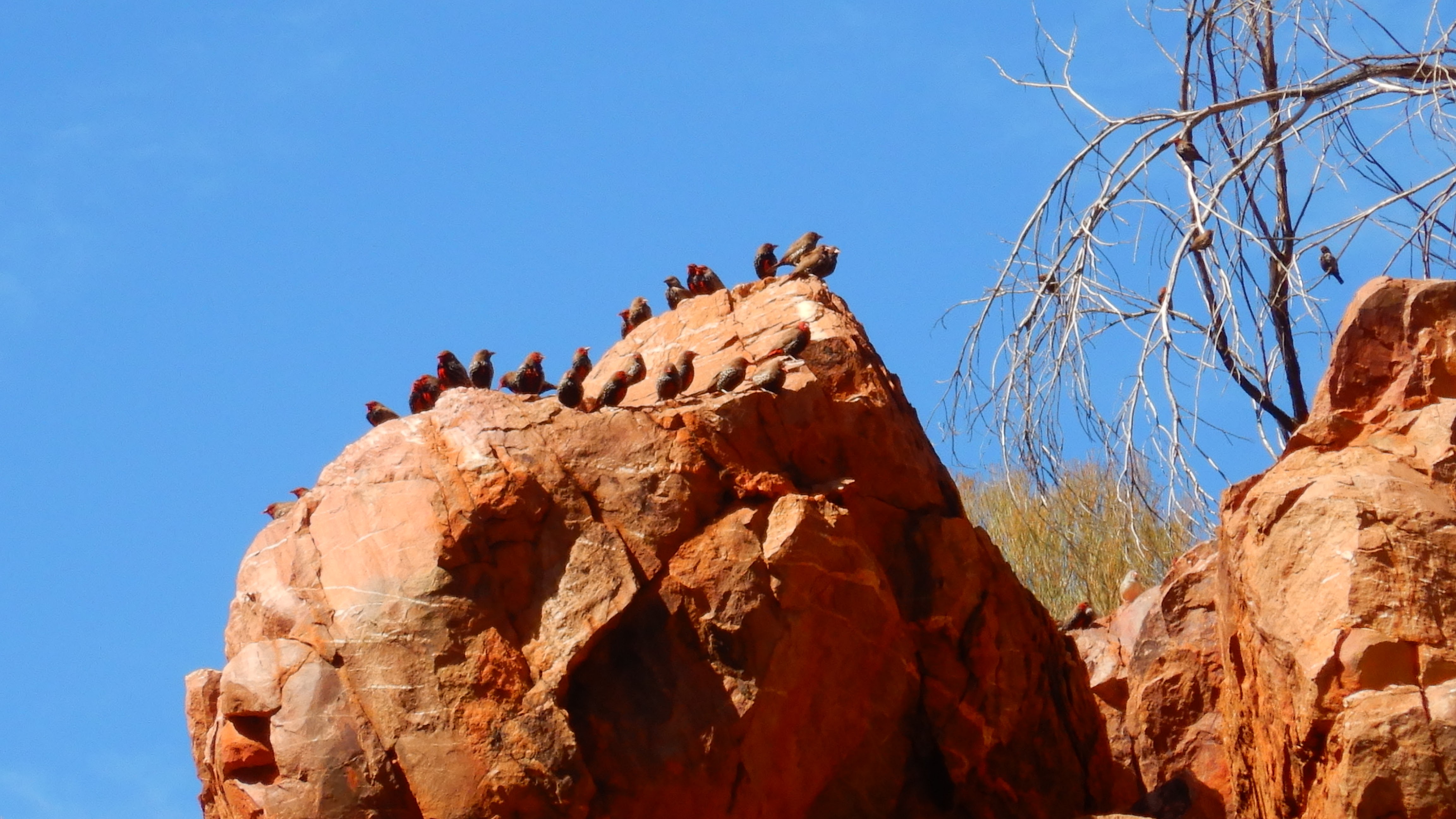
Here we had a nice lunch beside the rock pool that supplied the local birds (mainly Finches) and us with drinking water.

We filled up another seven litres (in addition to our normal seven litres) and after an hour's rest we headed up towards Giles Lookout at around 14:00. We took it very easy up the steep climb in the hot weather and made it to camp just after 15:00. The views were 360 degrees and blew us away. It was still a bit hot with not much wind or shade. Once we had the tent set up we relaxed while watching the most amazing sunset behind Mt Sonder.


The stars came out and we were watching them and a lot of shooting stars through the inner of our tent before falling asleep.
I was just thankful that Kerrie is a tough nut and seemed to have recovered well. This is just a lesson that we should always be aware that others don’t necessarily feel the same as ourselves.
Day 13 - Mt Giles Lookout to Ormiston Gorge
I got up at 05:00 to marvel at the stars and Kerrie joined me to watch the sunrise. This turned out to be our 'other' favourite campsite along with Stuarts Pass.
Today is bound to be a bit shorter and mainly downhill (this comes in handy for Kerrie to recover). The track started out following the plateau for about 2 km before dropping into the valley. The early morning light made the landscape magical.


I made sure that we took it nice and easy to conserve Kerrie’s energy, but she seemed to have a second wind and was powering along. Once at the bottom of the hill, the track was easy, well formed and a little undulating before a nice walk along the creek into Ormiston Gorge.


We arrived at Ormiston Gorge before noon and splurged out on a couple of Focaccia toasts and Magnum ice cream. It felt like heaven, and Kerrie felt like a queen after a hot shower. I couldn’t complain either as there was another small bottle of red wine stashed in the drop box. Tonight’s dinner treat was nacho chips and savoury mince whilst relaxing in the trail head shelter.

Day 14 - Ormiston Gorge to Hill Top Lookout
We had a bit of trouble getting to sleep the night before as there were another 16 other hikers and several large organised groups in the campground. Hence it took some time for everyone to settle down. We never had this issue with the hundreds of mice!
The original plan was to take it easy and head for Redbank Gorge in three days, but with the wet weather forecast in four days we decided to finish it in two days and then try for Mt Sonder before the rain.
Most of the hikers were having an extra rest day at Ormiston so we tried our best not to wake anyone while we packed up. On our way early i.e. just after light, we headed for the Fink River trailhead campsite. One kilometre out of Ormiston we crossed the river, which would have been a great alternative camp to Ormiston. It would have been a lot quieter and serene.

After another 4 km, we walked over a small hill (also called Hill Top Lookout), which also offered a few awesome campsites.

We made short work of section 10 of the trail, which was extremely easy and short, crossing Finke River into the camp for a quick morning tea.


All this water made for seeing some nice flowers.

Here we also filled up extra water for our dry camp tonight. This is the last time that we will have to slug the extra weight.
Going was easy past Davenport Creek which contained a lot of water...

....and we decided to have lunch at the bottom of Hill Top Lookout. From there it was a steady 2.5 km uphill on a very well-maintained track, which made carrying the extra water a lot easier. By now it was a lot windier and we were hoping to find a bit of a sheltered campsite on top of the lookout. We didn’t relish pushing on to Rocky Bar Gap camp in case it was too windy on the lookout. Lucky for us we found the perfect camp spot that was sheltered from the wind.
Looking for a site, ...


After setting up camp, we started cooking and were not so confident about getting a stunning sunset over Mt Sonder because of the overcast sky.
Today was also the first time that we used fly nets at the campsite. At least there don’t seem to be any mice. Must have been a change of guard.
Although there was no sunset and the wind increased, we still enjoyed the fantastic views of Mt Sonder and the final days of our hike. We went to bed a bit sad knowing that this would be our second last camp and nodded off to sleep listening to the howling wind.
Day 15 - Hill Top Lookout to Redbank Gorge
Overnight the wind picked up even more and there were times when we thought the tent might rip, but it held up well. The morning, as expected, didn’t provide us with a sunrise, but we still had coffee and breakfast enjoying the stunning views.

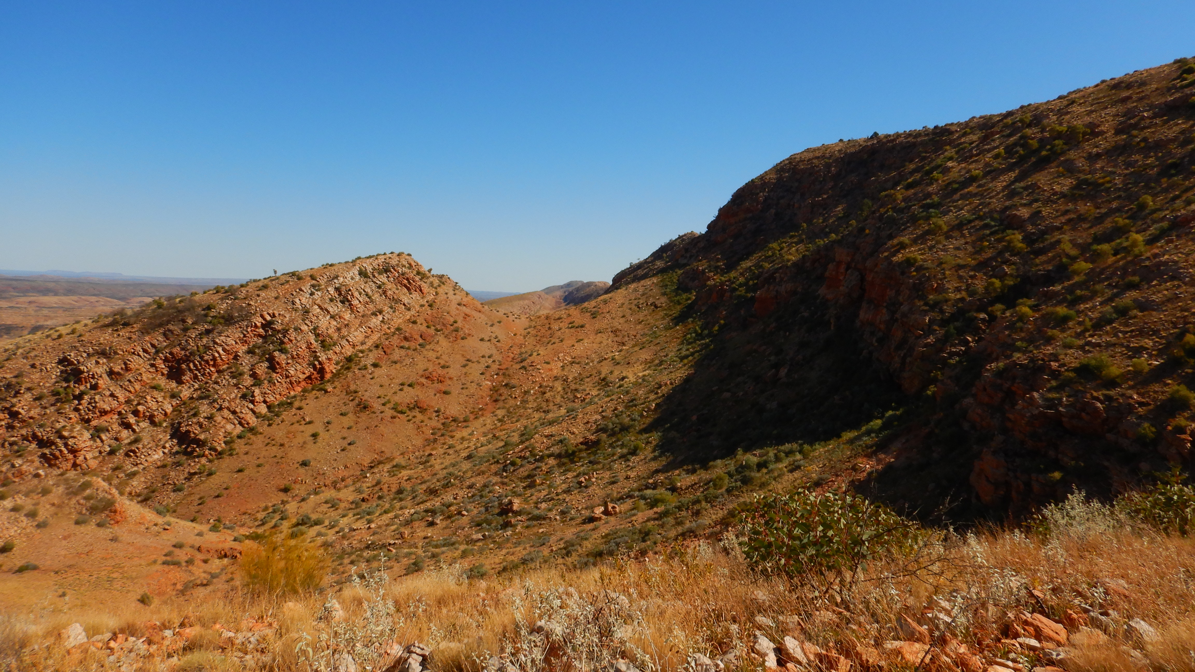
Packing up in the wind was challenging and we headed down the gradual slope towards Rocky Bar Gap. We both were a bit subdued as we were approaching the end of our hike. Rocky Bar Gap was easily navigated and we rocked (notice the pun) into the campsite for an early morning tea and a water refill. From here it was an easy walk all the way to Redbank Gorge. Overall we thought that today was probably the least interesting day, or maybe we were just too spoilt by now.


Arriving at Redbank Gorge campground for lunch we decided not to explore the actual gorge as we would come back here to camp with our trailer in a week or so anyway. But saying that when we came back to camp here, the gorge was awesome and a must-do to inspect and have a swim through.
We set up camp and it was great to talk to hikers that are about to set out on this great adventure in the opposite direction. We spent the afternoon relaxing in the trail head shelter in anticipation of our Mt Sonder ascent early in the morning before sunrise. We didn’t hold out too many hopes for sunrise as the weather was very overcast.

Day 16 - Redbank Gorge to Mt Sonder Summit
The proposed time it takes to climb Mt Sonder is 3.5 hours with a 2.5-hour descent. Hence I got up at 03:30 for my coffee fix. We only took water and warm clothes with us, leaving everything else in our tent. Heading off in the dark with no moon was awesome, but we were not alone. A lot of other hikers, including large groups, made the pilgrimage up the mountain and we observed a snake of lights winding up.
The track up Mt Sonder is well defined and relatively easy-going. The wind was freezing cold but at least it was not raining. About 500 metres from the top my head torch decided to give up its ghost and I stumbled in darkness following Kerrie’s light beam to the top. Here we joined at least another 100 people and settled in for sunrise. Unfortunately, we had an overcast morning, so no real sunrise but we still sat and watched in wonder as the light came over the landscape that had been our home for more than two weeks and it was very sad to leave the mountain top back to camp and so finish this epic adventure.

Length of Hike
230 km approx
Time
16 days (15 nights)
Best Time to do
May to August (we walked from mid-May and the weather was perfect)
Difficulty
Medium to Hard. The track is well defined and you can make it as easy or hard as you like.
No comments:
Post a Comment